Research is Essential
The main reason that his project is a collaboration between the University of Portsmouth and Just One Ocean is in order that we can undertake further research. For example, the data that we gather from the citizen science samples and analysis will enable us to evaluate the distribution and composition of microplastics. Images will potentially help us to identify shapes colours and potentially density. Physical samples can be further analysed for toxins and types of plastics.
Identification of Microplastics
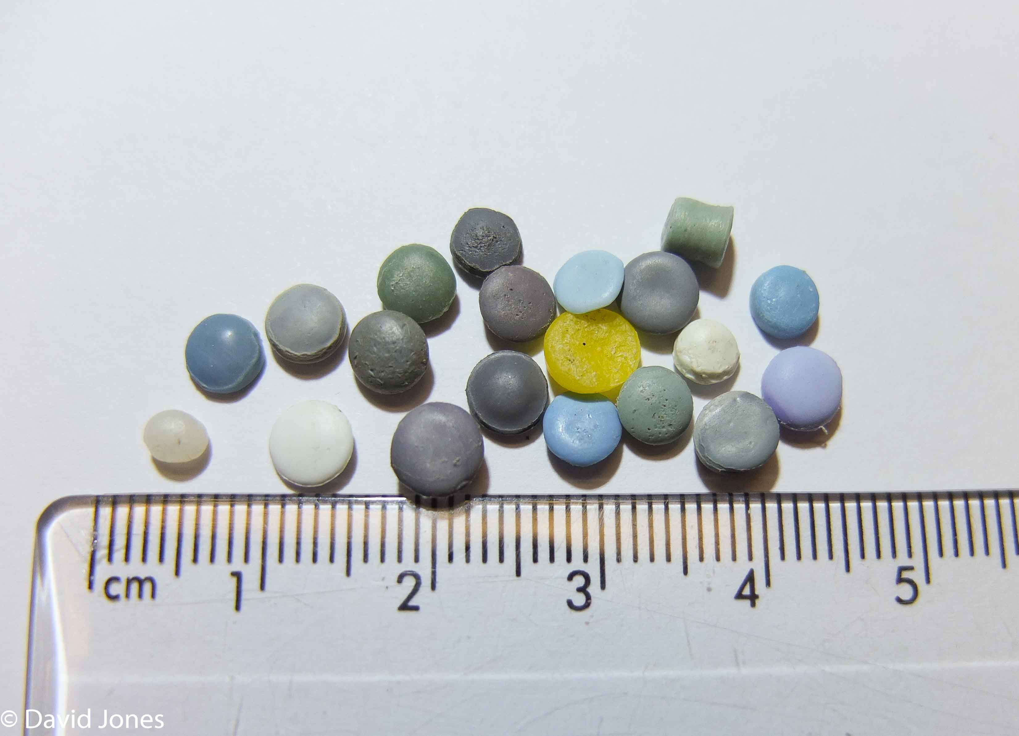
We are trying to find out as much as we can about the microplastics that are found in our lakes and rivers and around coastlines of the world. The reason we ask you to send us samples if you can is so that we can find out exactly what they are. The first part of this process is density separation – different plastics have a different specific gravity, that is the density of the subject when compared to water. Put simply, Polypropylene, Polyethylene and Expanded Polystyrene will float in seawater, other types of plastic will tend to sink. However to find out even more we need to get technical and use a FTIR scanner.
Database
There are still massive gaps in our scientific knowledge when it comes to microplastics. A key outcome of the research will be the establishment of an open access database so that we can record the data we collect, but also let other people use it for formulating policy and conducting further research. The data submitted will be categorised and held centrally. As we find out more and more, the types of information we gather will change and so will the database. It will be dynamic and under constant development.
We have built the database around an ESRI online programme. If you are registered you can apply to be a group member and share our data on your own platforms.
Mapping
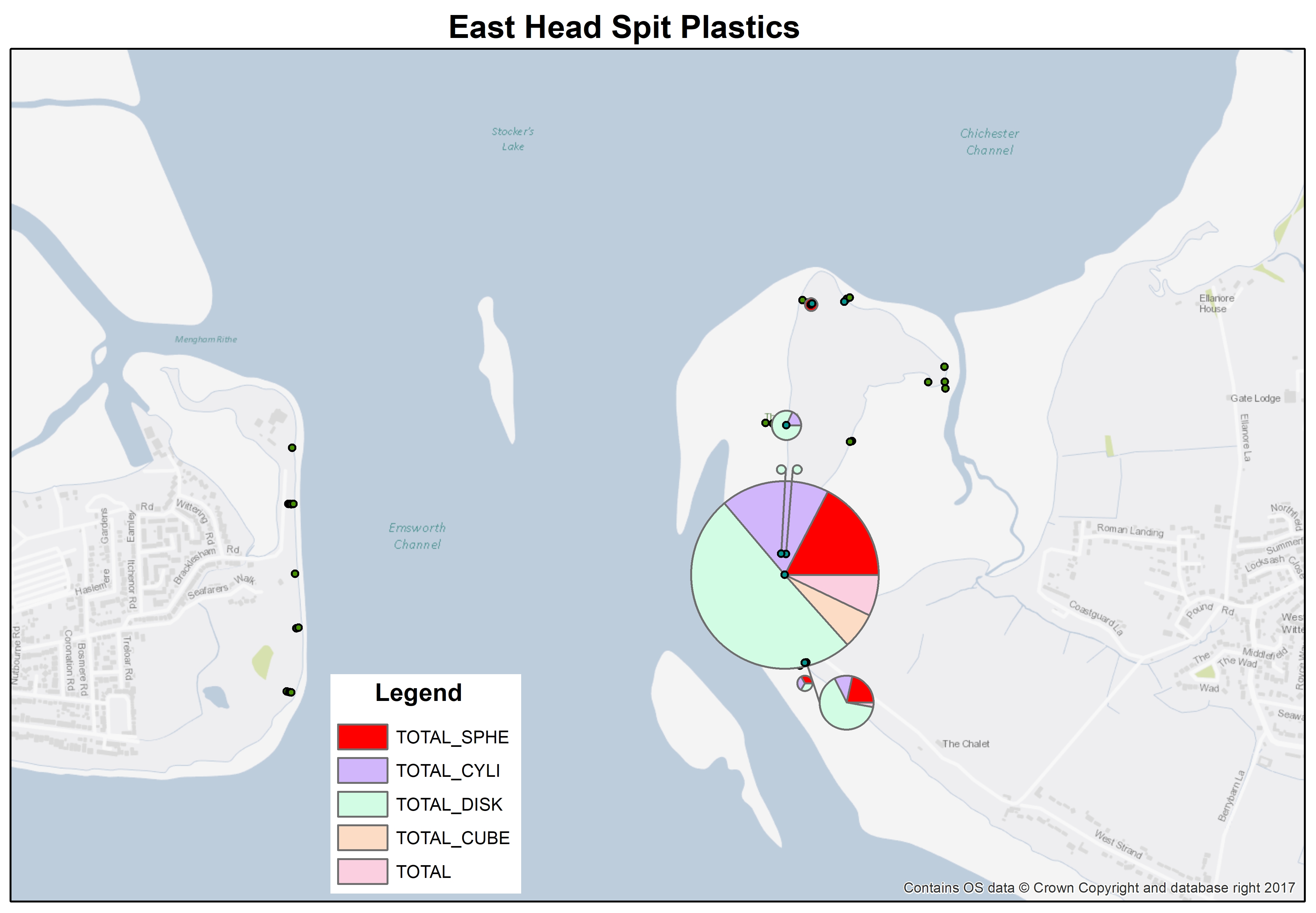
One of the outcomes of the survey will be the effective mapping of data using the data. This is being done with a Geographical Information System. Density, colours, types of microplastics and accurate locations will potentially enable us to target ‘hot spots’ and even take action in the future. There is a results page on this website showing some of the information that is available. As the data base and our understanding grows we will also potentially be able to start to analyse the movement of microplastics and mesoplastics. This mapping data will be available to those who need it.
Further Research
This project will provide us with a huge amount of data and plenty of opportunities. We will be undertaking additional research across a whole range of areas and to be honest, as the data available increases so will the scope of the research.
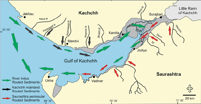
We aim to support undergraduate and postgraduate studies with the provision of data and hopefully funding. For example we are already looking into how existing data and knowledge of coastal sediment movement might be applied to the transport of microplastics and how wildfowl might be impacted.
Another key part of this programme will be the development of our survey techniques and digitising the process as much as possible. This will improve the process and make it more efficient.
As you can imagine all of these projects will require funding which takes time to gather, so we will keep you updated as we progress.